First Cruise Track Data Log Out | Topics | Search
Moderators | Register | Edit Profile

Electric Marine Discussions » Saddleback College MST Seamanship Classes » MST 214B Advanced Ocean Sailing [Spring] » Archive - 2003-2012 » 2011 MST 214B » First Cruise Track Data « Previous Next »

  Thread Last Poster Posts Pages Last Post
  Start New Thread        

Author Message
 

Ted Lavino
Moderator
Username: tlavino

Post Number: 179
Registered: 01-2006
Posted on Saturday, March 19, 2011 - 10:59 pm:   Edit Post Print Post

Folks here are a couple of images geo-referenced to Rhapsody's GPS track data.


You can see our trip to the fuel dock day 2 to fill water tanks, as well as us waiting outside the harbor for everyone else to catch up...

Avalon Harbor

Catalina Harbor

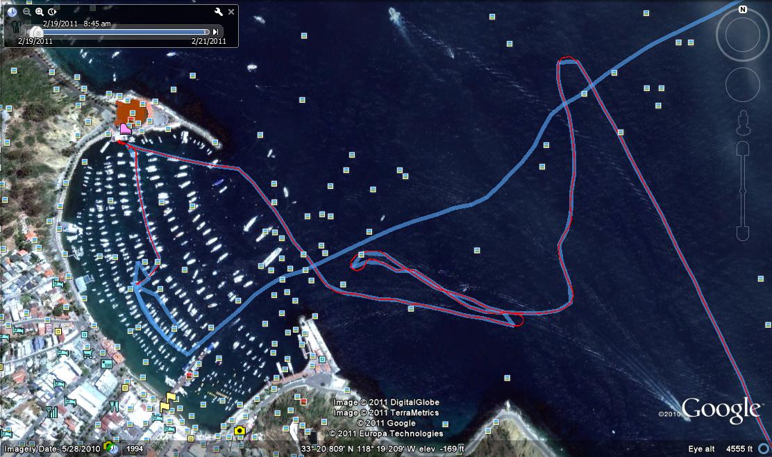
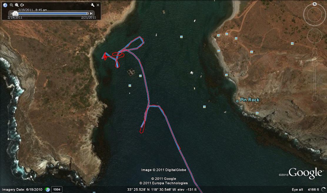
Our tracks from day 2 and 3 on the South side of Catalina. The jog that looks like a reversed "4" is us heaving to for lunch. The detour near Church Rock day 3 is us spotting a few whales to the South.


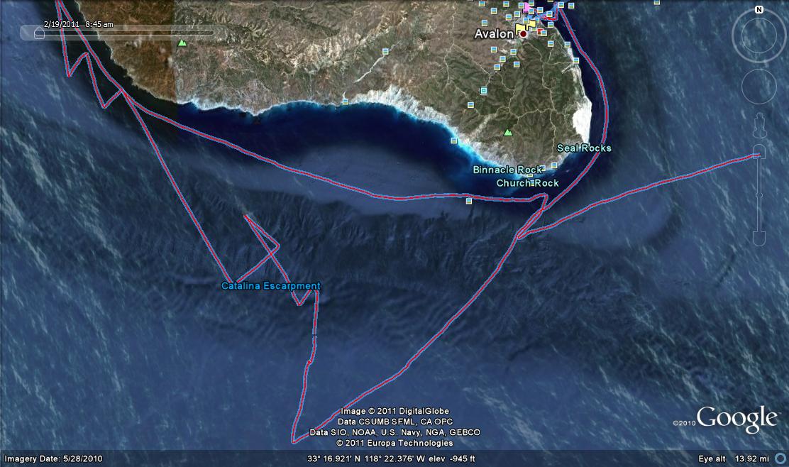
San Pedro Channel Crossing. I believe our batteries died on the way back...
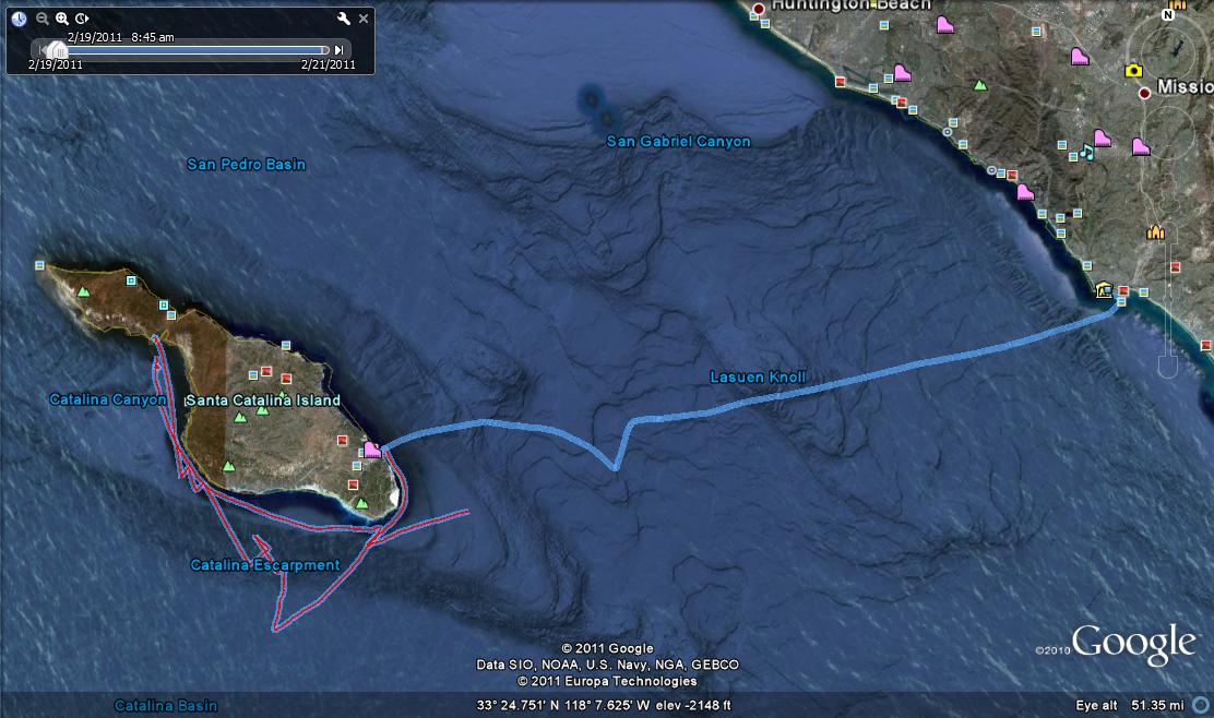
Add Your Message Here
Post:
Username: Posting Information:
This is a private posting area. Only registered users and moderators may post messages here.
Password:
Options: Enable HTML code in message
Automatically activate URLs in message
Action:

Topics | Last Day | Last Week | Tree View | Search | Help/Instructions | Program Credits Administration